InTrans / Dec 29, 2016
Breaking Point: Planning a hurricane exodus
Go! Magazine
 posted on December 29, 2016
How does transportation help us survive severe weather?
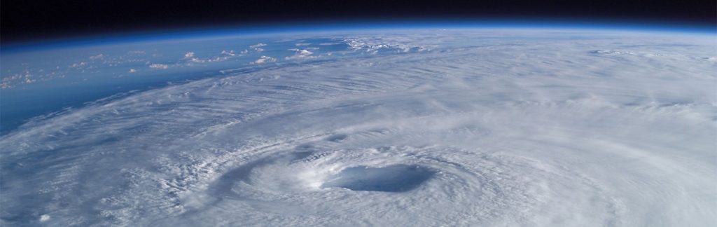
This month, we’ve already talked about severe winter weather and transportation in tornado alley, but what about something even more intense? How does transportation help people survive hurricanes?
When it comes to hurricanes, transportation plays a huge role in moving people safely and efficiently from the area. Multiple aspects of transportation and infrastructure need to be thought out months or even years ahead of time in order to move people without panic when the time comes. 1
Planning for disaster
Hurricanes are much larger but somewhat more predictable than tornadoes or snowstorms.
That said, hurricanes call for proper evacuation plans and “inter-agency” cooperation across the board. From federal agencies like the Federal Highway Administration to state departments of transportation (DOTs), private towing operators, trucking organizations, and paratransit operators, transportation needs to happen on all levels in order to keep people safe.
Evacuation plans also call for modeling and simulating decades of flood mapping and highway data. When it comes to transportation, these evacuation plans call on the expertise of traffic, highway, and civil engineers. Together, engineers work with other aspects of the local and federal governments to create “evacuation plans to fit the needs and peculiarities of each community.” 2
Getting out
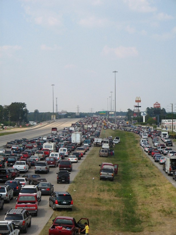
Unlike tornadoes, which often happen in the middle of nowhere at best and destroy a small town at worst, hurricanes can call for millions of people to flee their homes.
So, what are some specific ways that transportation is used to save lives?
To best evacuate an area, exit routes are planned months or even years before hurricane season. Transportation planners use tools like flood maps and atmospheric modeling to predict the best plan of action. These planners create computer simulations of their predictions.
These tools can help the planners predict hazards like wind, flooding, and storm surge. The computer simulations allow transportation planners to “tinker” with their predictions down to the smallest detail.
Transportation experts sometimes even run their experiments and predictions during less high-stake events such as after large sporting events. They test their theories about traffic signals, contraflow, and how to “generally get tons of people out of one place.” 3
Highway to higher ground
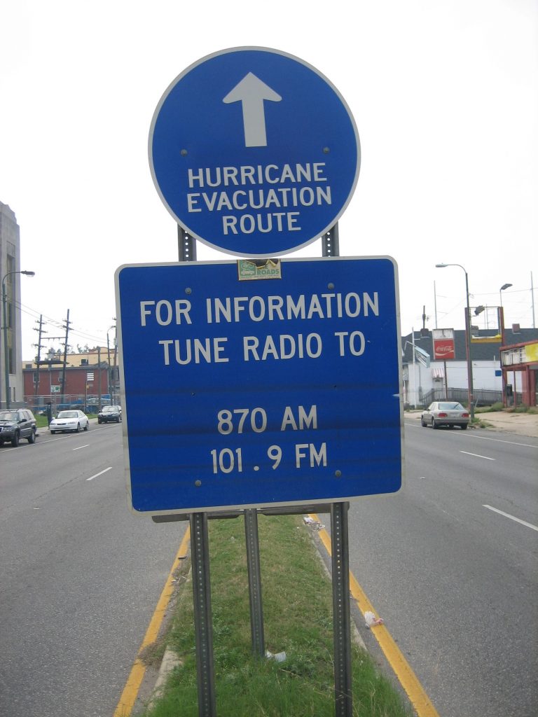
“Contraflow” is what traffic engineers call it when normal traffic is reversed to aid an emergency evacuation.
Evacuation plans often call for contraflow, reversing the highway lanes and directing everybody in one direction—away from the storm. More rural areas typically direct their residents toward one major highway and often physically block off smaller roads. Though it leads to traffic jams, officials prefer to have the population bunched together for safety.
Local governments often direct traffic through TV and radio and, in recent years, social media and online tools—like maps and updates of hurricane evacuation zones—have been used as tools to inform and navigate groups of people or communities.
Hurricane 411
In the United States, the East Coast, which runs along the Atlantic Ocean, is the most likely to experience hurricanes. Typically, states like Florida, Louisiana, North and South Carolina and other southern coastal states are most likely to be hit.
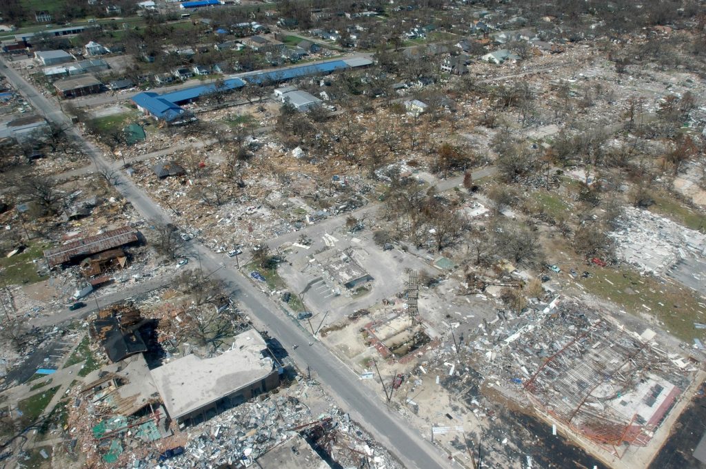
Those concerned with transportation evacuations also admit that these storms are getting worse and evacuation planning needs to evolve with the community in mind. Understanding infrastructure needs and collecting data for proper planning are more important than ever, so how can you play your part?
When it comes to being safe at the breaking point, planning hurricane evacuations on a mass scale may be the best example of why the world needs transportation planners and engineers. As time goes on, the environmental crisis is forecasted to retrogress. So, do you have what it takes to be a transportation planner or engineer?
Citations
- https://www.wired.com/2016/10/move-2-million-people-hurricane-matthews-way/
- https://www.wired.com/2016/10/move-2-million-people-hurricane-matthews-way/
- https://www.wired.com/2016/10/move-2-million-people-hurricane-matthews-way/
Related links
www.accuweather.com/en/hurricane
By Hannah Postlethwait, Go! Staff Writer