Project Details
09/28/16
01/31/19
Georgia Department of Transportation
University of Georgia
Researchers
Bora Cetin
About the research
This study compares the predicted distresses of asphalt concrete (AC) and jointed plain concrete pavement (JPCP) using four different climate data sources: (1) ground-based weather station (GBWS) data, (2) the North American Regional Reanalysis (NARR) data, and (3 and 4) the Modern-Era Retrospective Analysis for Research and Applications (MERRA) versions 1 and 2 (MERRA-1 and MERRA-2) data. The results indicate that pavement performance predictions generated using these data showed disagreement among some of the climate data sources, especially for MERRA-2. Comprehensive diurnal and time-series analyses of the raw climate data found significant disagreements in the percent sunshine data. Percent sunshine is used in the Pavement ME Design environmental effects model to semi-empirically estimate the shortwave radiation reaching the pavement surface, the major driver for pavement heating and cooling. The MERRA-1 and MERRA-2 data independently provide direct predictions of surface shortwave radiation (SSR); these values were found to agree with “ground truth” measurements of SSR from the U.S. Climate Reference Network (USCRN). The direct model predictions of SSR were used to back calculate “synthetic” percent sunshine for input into the Pavement ME Design software. Use of the synthetic percent sunshine derived from predicted SSR eliminated nearly all discrepancies in predicted pavement performance using MERRA-1 vs. MERRA-2 data. Based on these results, the authors recommend SSR rather than percent sunshine to be used as input into the Pavement ME Design software.
Project Details
02/01/03
12/01/07
American Concrete Pavement Association
Concrete paving industry
Federal Highway Administration
Georgia Department of Transportation
Indiana Department of Transportation
Iowa Department of Transportation
Kansas Department of Transportation
Lousiana Department of Transportation
Michigan Department of Transportation
Minnesota Department of Transportation
Nebraska Department of Roads
New York State Department of Transportation
North Carolina Department of Transportation
North Dakota Department of Transportation
Ohio Department of Transportation
Oklahoma Department of Transportation
South Dakota Department of Transportation
Texas Department of Transportation
Wisconsin Department of Transportation
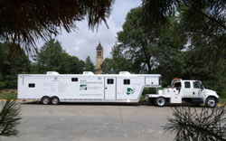
Researchers
Jim Grove
Fatih Bektas
About the research
The objectives of this five-year Transportation Pooled Fund study are to evaluate conventional and new technologies and procedures for testing concrete and concrete materials to prevent material and construction problems that could lead to premature concrete pavement distress, and to develop a suite of tests that provides a comprehensive method of ensuring long-term pavement performance. A preliminary suite of tests to ensure long-term pavement performance has been developed. Shadow construction projects are being conducted to evaluate the preliminary suite of tests. A mobile concrete testing laboratory has been designed and equipped to facilitate the shadow projects. The results of the project are being compiled in a user-friendly field manual, which will be available by summer 2006.
Project Details
08/01/98
07/31/05
Delaware State Police
Florida State University
Georgia Department of Transportation
Iowa Department of Transportation
New York State Police
North Dakota Department of Transportation
South Dakota Department of Transportation
Researchers
Reginald Souleyrette
About the research
The ILT is a Map Objects/Visual Basic application for locate incidents such as crashes and traffic violations using a digital map. The ILT is an integrated component of an electronic forms management application called Traffic and Criminal Software (TraCS) developed by Iowa Department of Transportation. TraCS is currently a multi-state, collaborative effort involving law enforcement and transportation agencies from 23 States and a Canadian Province.
The ILT is designed for ease of use by users lacking prior technical exposure to GIS or GPS applications. The geographic data supporting the ILT serve as the basis for a multitude of programs and systems within Iowa, in contrast to the obsolete node-based referencing scheme previously used solely for the location of crashes. The ILT allowed the Iowa DOT to end the maintenance and production of nodes for crash location referencing purposes, and simultaneously, yield greater return on investment in geographic information system data developed and maintained for other purposes. The ILT has been customized for and deployed in several states (see the list of sponsors).