InTrans / Jul 22, 2015
Town by Town: Suburban living
Go! Magazine
 posted on July 22, 2015
This article is a continuation of the article “Suburban sprawl series: Wait, what is a suburb?” In this article, we’ll be taking a look at how growing suburbs (i.e., residential areas outside cities) are creating challenges for transportation planners.
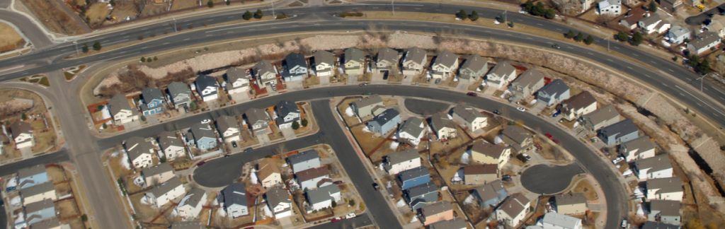
Suburbs have gone through several changes since their initial explosion in popularity following World War II. For years, the typical suburb was fashioned for mainly car traffic. This meant no sidewalks, disjointed strip centers, or large street-side parking lots. Doesn’t sound very “walk-friendly” does it?
Let’s use Houston, Texas, as an example. This city’s population has grown by more than 120,000 residents every year since 1980. This growth is only expected to continue, with the population of 5.8 million in 2010 to increase to over 9.6 million by 2040. And as Houston’s population grows, so does the surrounding suburbs. So, as more people live outside the city, commutes by personal car are becoming more and more congested as an increase in people utilize the same roads.
In an interview with one Houston resident, he said that his commute of 35 miles keeps taking more and more time – “…probably up to an hour and five minutes each way.” If he is traveling at a consistent speed that means he is traveling an average of 32 miles per hour on the highway!
Houston anticipates that the current miles traveled per person (called “vehicle miles traveled”) will increase from 27 to 30 miles per person by 2040. And with more people moving to Houston’s outer suburbs this could mean a lot more traffic jams.
What can be done?
Like many places around the country, Houston residents’ main mode of travel is by personal vehicle; in fact, nine out of ten commuters use a personal vehicle. Due to the increasing population and outward growth, Houston has created a 2040 Regional Transportation Plan (RTP) that is meant to help offset some of its current challenges. With so many people on the road every day, there are increased concerns for safety, traffic congestion, air quality, and overall infrastructure conditions.
So how do you change the habits of drivers commuting to and from the suburbs when that was originally the plan? Well, let’s see!
Will public transit work in Houston?
Through a public input process that included outreach events, media coverage, and presence at numerous venues, it was decided that more could be done to improve access and usability to public transit. Did you know that current public transit options take an average of 20,000 cars off the road every day?
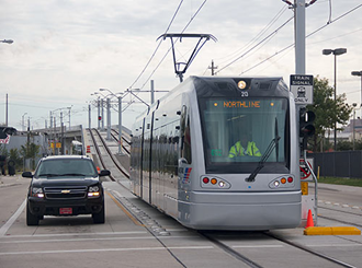
Houston’s plan does include expanded public transit lines, which will be vital, for instance, to the increasing populations of older adults, commuters without personal vehicles, and students traveling to the University of Houston. In fact, Houston’s first light rail service runs through the historic downtown area—one of the most congested areas in the whole city—and has had great ridership at almost 44,000 riders each week. With the addition of two new rail lines, Houston will add 10 more miles to its system.
Infrastructure improvements in the plan also include a separate lane for buses to add convenience and speed for bus commuters. And they didn’t forget about the students, because the plan even includes an increase in buses in highly congested areas, such as near the University of Houston campus, which in 2012 included a population of nearly 41,000 students.
What about making a more “compact” city?
One of the more practical options to decrease personal car traffic is to make amenities closer together. Although Houston is spreading outwards, there is also an opportunity to start “filling in.” The fact is that more dense living spaces can lead to greater transportation options, which leads to less expensive travel options.
Houston’s 2040 Regional Transportation Plan fosters the idea of “mixed use development,” or a single building that brings a combination of residential, commercial, cultural, institutional, or industrial uses together under one roof. The plan encourages various investors to develop areas considered “walkable.” This includes rehabbing existing structures not being utilized (such as an empty stores in a strip mall), relocating parking lots, and adding more sidewalks. How does this help? Well, this makes the redeveloped area more attractive to on-foot commuters while still being driver friendly. At the same time, this type of compact development can help Houston better address their initial concerns about safety, traffic congestion, air quality, and overall infrastructure conditions. These developments will ultimately increase the quality of life for Houston residents, which is the real goal here.
By Jackie Nester, Go! Staff Writer